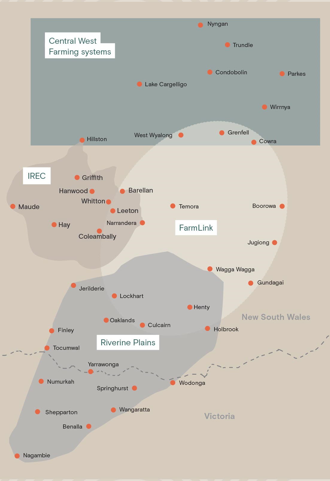
Our coverage is around the general area of the towns below, but these are a guide only. Refer to the map under the lists for exact boundaries.
Central West Farming Systems
- Nyngan.
- Trundle.
- Lack Cargelligo.
- Condobolin.
- Parkes.
- Wirrnya.
- Hillston.
- West Wyalong.
- Grenfell.
- Cowra.
IREC
- Griffith.
- Hanwood.
- Barellan.
- Whitton.
- Maude.
- Leeton.
- Hay.
- Narrandera.
- Coleambally.
FarmLink
- Temora.
- Boorowa.
- Jugiong.
- Wagga Wagga.
- Gundagai.
- Other overlapping areas.
Riverine Plains
- Jerilderie.
- Lockhart.
- Henty.
- Oaklands.
- Culcairn.
- Holbrook.
- Finley.
- Tocumwal.
- Yarrawonga.
- Numurkah.
- Springhurst.
- Wodonga.
- Shepparton.
- Wangaratta.
- Benalla.
- Nagambie.
