The Weed Manager’s Guide To Remote Detection
- Home
- About us
- Detecting weeds
- Get involved
- Resources
Now searching for:
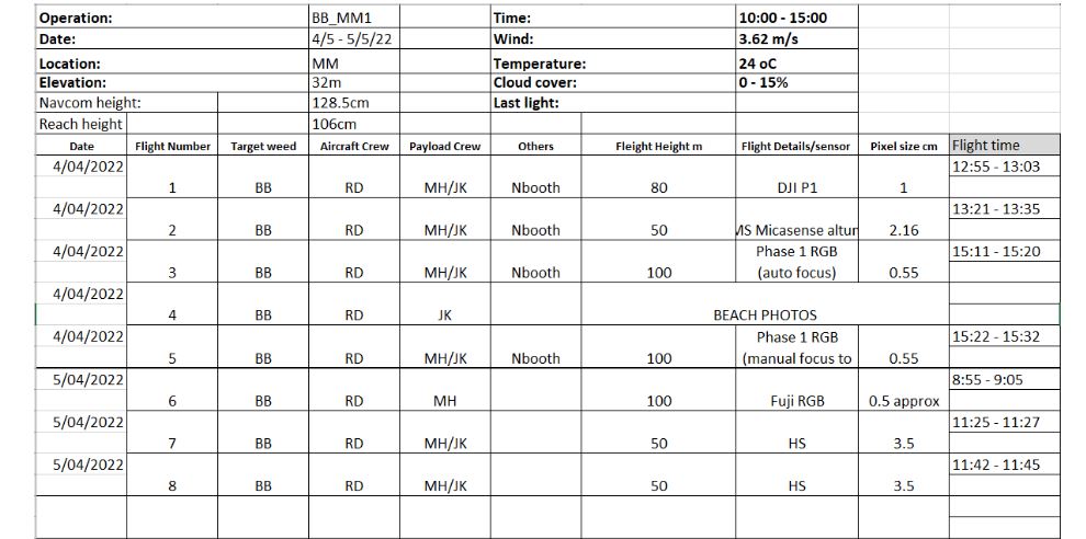
The recording of flight data is important for troubleshooting when imagery quality is low and to explain unexpected issues in the data when processing. Flight logs provide a written record of all flights undertaken and the weather conditions and camera settings that were in place during each flight.
Information can be recorded in a simple spreadsheet and saved to a data file and the information can be written in pen in the field or can be converted to a digital data collection app to remove the need for manual data entry in the field.
Typical flight log information may include broad information such as:
Data collected for each flight might include:
Figure 3 shows a typical filled in flight log sheet for a Bitou Bush site (MM):
Additional data collected during weed detection flight missions will include ground truthing information which is absolutely essential for effective image analysis and processing and facilitates detection capacity.
